At the weekend I ran into a friend who had been out on his bike and had been cycling along a new path. Well, it’s not really a new path in that the existing path has been on Ordnance Survey maps for a long time, and is actually part of the London Loop, the trail that runs around the edge of Greater London.
The existing path was particularly treacherous during the winter, since it runs along Salmon’s Brook, a small tributary of the River Lea. The land surrounding the brook has long been arable land and water tended to gather near the brook making it hard going unless you had wellies. If you attempted parts of the trail too soon after a deluge, you might find that the trail had been subsumed by the brook itself.
Anyway, a group called Thames21 has been working to restore Enfield Chase and Salmon’s Brook by planting 100,000 trees to create new wetlands, and slow down rainwater before it reaches the brook. This in turn should reduce flooding and improve pollution.
The work has been ongoing for over a year – and I know I should have volunteered (much of their work is done during the weekday). But I’ve seen a number of local fields being given back over to trees.
But although I’d been aware of the work that was happening, until I met my friend, I hadn’t realised that they’d completely refreshed the path, laying down a firm surface, and looping the new path away from the existing right of way. The section they’ve worked on can be seen in the OS Map.
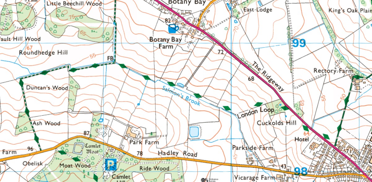
The London Loop route is shown with dashed green diamonds, coming down from Rectory Farm in the east, reaching The Ridgeway, crossing it and heading up the delightfully named Cuckolds Hill, into a small wood called Brooks Wood (named after my next door neighbour as a child, following his sad early death – he was a local councillor). Then it runs down the hill quite steeply to Salmon’s Brook before looping around back up Ferney Hill to reach the edge of Trent Country Park where an obelisk is very visible.
The park also includes Camlet Moat which dates from the 14th/15th century when it was probably used to detain people who broke the strict rules of the forest. This entire area – Enfield Chase – was the king’s hunting ground and would have been forest.
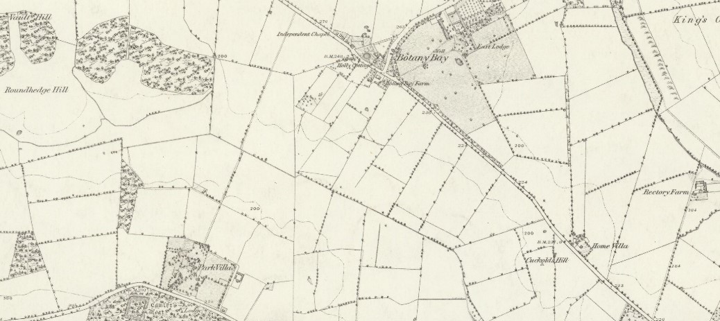
This map from 1866 shows the same area.
[Interestingly there is a place called Home Villa near the top of Cuckold’s Hill which no longer exists – there’s a mobile phone mast there and not a lot else now. Postwar it seems to have become the Ridgeway Country Club, but then by the 70s it seems to have gone. Something to explore…]
What the older map shows is that the forest had long gone, and by the mid-19th century this was arable land.
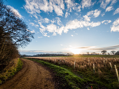
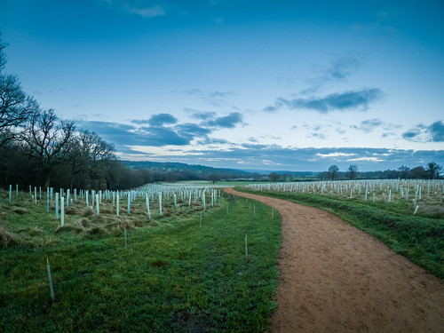
Which brings us to today. The other morning I went for a run along this “new” path and it’s fantastic.
From the east it begins near Rectory Farm crossing a field diagonally to take a more direct route to the point where you cross The Ridgeway. Then the new parth sweeps down Cuckolds Hill in a wider route before following Salmon’s Brook and sweeping again further away from its banks.
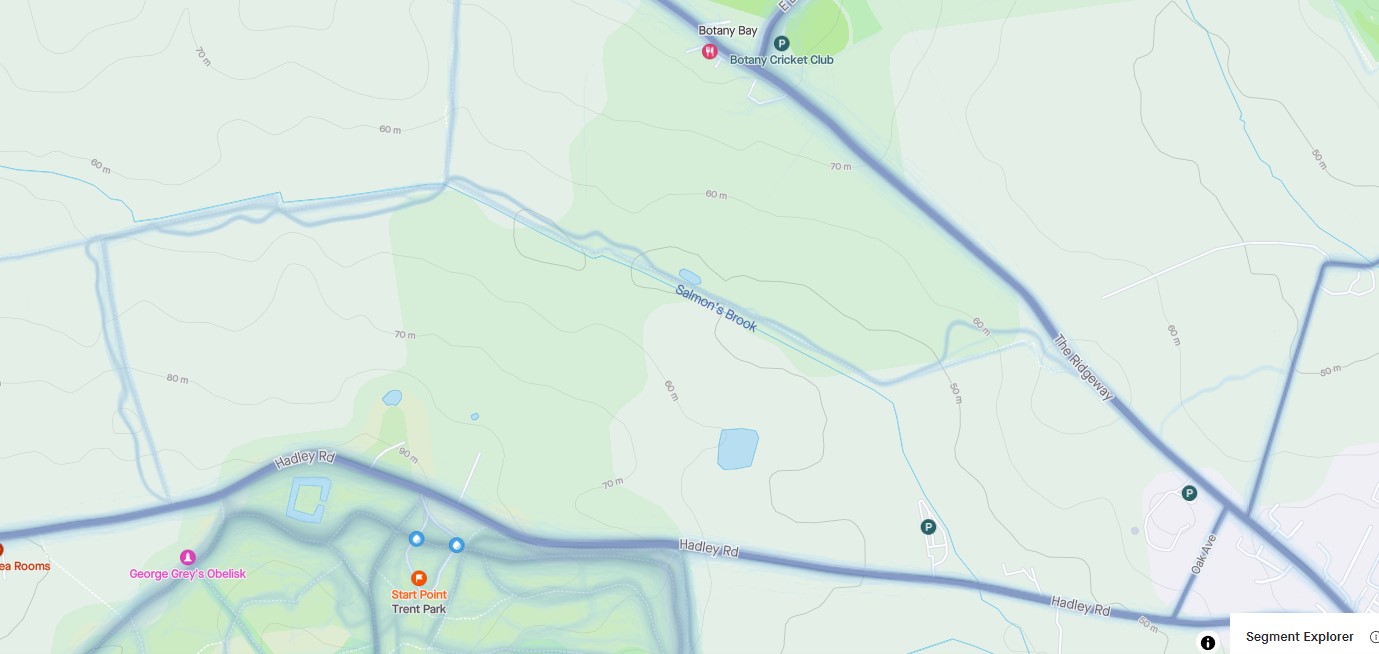
The map above is a “heatmap” from Strava which shows where people are running and cycling. You can see a faint blue line on the right from Rectory Farm running to The Ridgeway (although most still use the straight track). Then from Cuckolds Hill you can see the old path ran straight down the hill but people are now running on the new path around a loop. Further along Salmon’s Brook you can see that the new path diverges from the old path following a more “sweeping” line and keeping you further away from the water’s edge, and hence less likely to meet flooding. They have also engineered ditches and run-offs to avoid the new path being flooded.
Finally, there are logs at various points creating seated areas. While this is a lovely place in winter, it’s glorious in summer with the trees and farmland surrounding you.
Anyway, here are some photos from my run the other day. I need to go back on a frosty morning!